
US
Florida's Space Coast floods again after nearly 100 rescues as horses are led to safety and the St. Johns River breaks a 1953 record
More rain hit Brevard County Friday after nearly 100 water rescues. Schools and county offices closed as the St. Johns River topped its 1953 record.
Florida's Space Coast woke up under water again on Friday. A storm system that has been parked over the peninsula all week pushed more heavy rain into Brevard County overnight, a day after crews pulled close to 100 people from flooded homes and cars.
Brevard Sheriff Wayne Ivey said deputies, fire crews and partner agencies were out on high-water rescues again from first light Friday. County government offices stayed closed to the public and every Brevard public school shut its doors for the day. Emergency managers asked people to stay home if they could.
Rescues for people and horses
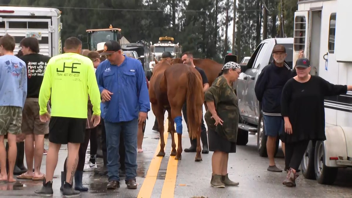
The worst of it hit Thursday. In Cocoa, volunteers hauled horse trailers through knee-deep water to lead dozens of horses and other animals out of the Blue Lake Equestrian Center, an animal hospice and boarding barn. The animals were moved to a dry pasture on higher ground.
Palm Bay ordered some residents of a mobile home community to leave. In Rockledge, water reached the tops of mailboxes on some streets in the Green Acres neighborhood. Shelters opened in Cocoa and Melbourne for families who had to get out.
Jazmin Foster said floodwater got inside her Melbourne home on Thursday, two weeks after an earlier flood that her insurer refused to cover. "Never seen such a thing like this in Florida," she said. She is pleading for more federal help for her neighbors.
A river above its 1953 record
The St. Johns River near Cocoa climbed past a record flood mark that had stood since 1953. Forecasters expect it to stay at least 2 feet above flood stage into early next week, so many low streets will not dry out soon.
Overnight the weather service in Melbourne put out two more flash flood warnings for north and central Brevard. By early Friday it said up to 2.5 inches had fallen in a few hours with 1 to 2 more inches possible around Titusville, Cocoa, Merritt Island, Cocoa Beach and Viera.
The state has sent nearly 200 Florida National Guard members with 50 high-water vehicles along with about 235 state wildlife officers to help with rescues.
What is driving it
The rain began in South Florida earlier in the week, where the Fort Lauderdale area took in close to 17 inches in 48 hours. Fort Lauderdale, West Palm Beach and Melbourne have all logged their wettest November on record, in what is supposed to be the dry season.
Forecasters blame a stalled front in the Gulf working with high pressure to the north, which keeps pumping moist ocean air onto the peninsula. El Niño is feeding the pattern and scientists say it could keep Florida and California soggy through the winter.
Weekend outlook
A low-pressure system expected to form off the Southeast coast on Friday could turn into a subtropical or tropical storm. It would bring strong wind, rough surf and coastal flooding up the East Coast into early next week, just as Thanksgiving travel begins.
Brightline halted its trains between Orlando and West Palm Beach for Friday because of high water along the tracks. The Space Coast Marathon and Half Marathon set for this weekend were called off. Officials repeated the usual warning: never drive into a flooded road.
More like this
Historic Florida flooding forces polling places to move on Election Day
Historic Four Corners flooding forces rooftop rescues and 1,500 evacuations as more rain looms
Nor'easter takes aim at the Outer Banks as Hatteras Island visitors are ordered to leave
Tropical Storm Rachel leaves Long Beach homes unsafe and sets a Las Vegas rain record